
Steeped in complements
Complementary assets, or things that help us do things.

Hey team,
Last time we considered dominant designs. Those accepted forms that we have become so used to. Interestingly some designs have become so familiar that even when the previous necessities of those designs have evolved, sometimes the form remains the same. Electric cars are a good example, they look the same, even though they have no engine at the front. Weird.

Today, though let’s talk about a concept that arose a few times in the last discussion: complementary assets.
Complementary, not free
Note the spelling, we are talking about things that align, that complement, not things that are “on the house.” Complementary assets are things, ideas, practices or activities which might not be immediately related to our interest but provide a supportive mechanism. So, without trains, we don’t get cheap goods in Costco. Without the internet, we wouldn’t have Spotify. You probably get the picture. These are things which allow us to do other things.
What is really interesting about complementary assets is how they evolve independently from each other and without our involvement. I am not deeply involved in wireless protocols and connectivity technology, but I can certainly benefit from better data transfer rates. More to the point, my business and yours can also benefit from those increased data transfer rates. Better connectivity is a tremendous complementary asset for the entire technology sector.
Last time we talked about dominant designs. The interesting thing about dominant designs is that they typically reach a point of stagnation. In reality, washing machines have not gotten much better in the last couple of decades. But these designs can suddenly change when the suite of complementary assets changes around them.
Indeed, with new complementary assets emerge new capabilities. And this is pivotal for the activity of digital geography. I see at least five, but very likely more, complementary assets each of which independently changes what we can do but together have entirely changed the nature of what the geospatial sector is capable of. I will talk about each I see briefly here but reserve the right to talk about each one for longer (especially if I start running out of good ideas!)
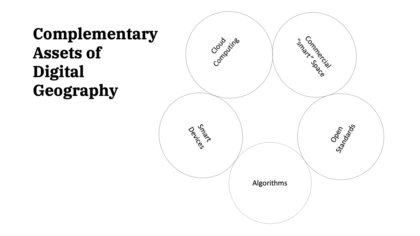
Smart devices
Today, 80% of the world’s population has a device smart enough to provide a geographic position via GPS (the Global Positioning System). The most advanced smartphones now also carry LiDAR (Light Detection And Ranging), another geographic sensor. Ten years ago, only the most advanced recreationists had access to handheld GPS, and handheld LiDAR was a professional tool. From a sensory perspective, individuals can now locate themselves on our planet with unprecedented precision and accuracy. Location is not now the domain of experts; navigation has become a default activity of smart devices. One need never be lost again.
Commercial space
Access to space, particularly Low Earth Orbit, has become significantly easier in the last decade. SpaceX has paved the way for an increasing number of commercial rocket launching companies, reducing the cost of achieving orbit, which in turn has driven the interest in more and more novel satellite capabilities being launched. We could spend a great deal of time further segmenting “commercial space” much further, but as far as we geospatial strategists are concerned: access to space means more space-borne sensory data. These data products might be better location services, radio frequency signals, Synthetic Aperture Radar (SAR) or good, old-fashioned pictures. The point is that a tsunami of data is flowing out of the sky.
The cloud
This amount of data capture also has tremendous implications for connectivity and data storage providers. However, in many ways, the cloud has provided a canvas on which to paint the contents of the imagination of the modern technology sector. The notion of conceptually infinite compute implies that, within a fiscal reality, a technology company can achieve what would have been impossible only a few years ago.
The steady pace of cloud advancement continually pushes back the edge of the “computing possible.” In addition to the infinite compute capability, the ease of networked access should not be ignored. Pre-cloud architectures were limited by potential entry points; now, we can easily connect to a cloud architecture via a cellular network. The cloud can be thought of as the infrastructure necessary to direct the flow of traffic and data across the web in a controlled and scalable manner. The result is that companies of any size can engineer solutions with conceptually infinite compute and massive accessibility without huge capital investment.
Algorithms
A frequent discussion in the geospatial community is “so what?” If we are being delivered with more imagery, what can we do with this tsunami of pixels with only so many eyes to look at images? Algorithms plumbed into a cloud pipeline and automated can turn data into insight. Whether these algorithms are monitoring plant health, slope stability, counting cars, or measuring some other element of our physical surroundings, the rise of a culture of algorithms has supported the increased use of high throughput data streams like those from LEO. This evolution has been accelerated partly by the computer vision and artificial intelligence communities, bolstering healthy spectral and active sensor research communities.
Algorithms are our data refining capacity - distilling the raw pixels into products of value. Pixels absent of interpretation (by humans or algorithms) are virtually meaningless - just numbers in mathematical arrays.
Openness
Finally, open standards support interoperability and encourage full competition. Whether these standards are being used in software or in data management, commonly understood data formats and processing practices help in the adoption of new technologies. The Open Geospatial Consortium (OGC) has been influential in advocating for open geospatial standards since 1994. Recently these standards have evolved to support higher-throughput data sources like those flowing from constellations of sensors. For instance, the SpatioTemporal Asset Catalog (STAC) standard has been adopted into the OGC API. This will result in a common way for machines and people to search for imagery. Such a simple open standard allows organizations to easily search for data from different sensors using a common toolkit.
Openness goes much beyond just open standards into the worlds of open source technology and open data. I would argue that these concepts have significantly altered the landscape of geospatial technology. So much so that each of these will certainly merit their own discussions. Indeed looking at the subject of open innovation, in general, is a worthy and complex task.
I am sure there are many more assets in other parts of the geospatial landscape that I have missed. I would love to hear about them from you. Please share and comment.
Next time, I’m going to take this a step further and talk about how complementary assets can combine and interact with each other.
Felt the need to leave some links for your future readers. https://www.c2labs.com/post/c2-labs-develops-a-bring-your-own-algorithm-byoa-approach-for-the-fight-against-cancer, https://github.com/C2-Labs/c2labs-ornl-challenge, and https://smc-datachallenge.ornl.gov/ch6-satellite-datasets/
Where did the audio go? I have to read this text now :( what if someone cannot read... ignore :)