(Inter)facing the future
The interface has always been a critical component of any web experience. Does that change when we are making our own personal software experiences?

Famously, Google changed the way the internet community thought about interfaces by applying simplicity to its search. Instead of providing an interface that demonstrated how clever they were, they provided an interface that highlighted their care for the user. An interface so stupidly simple that anyone could use it, and as a result, everyone did. We could argue that this was the dawn of User Experience. I’m sure UX goes back much further, but I think it’s fair to say that this was an early demonstration of the power of a user-focused approach.
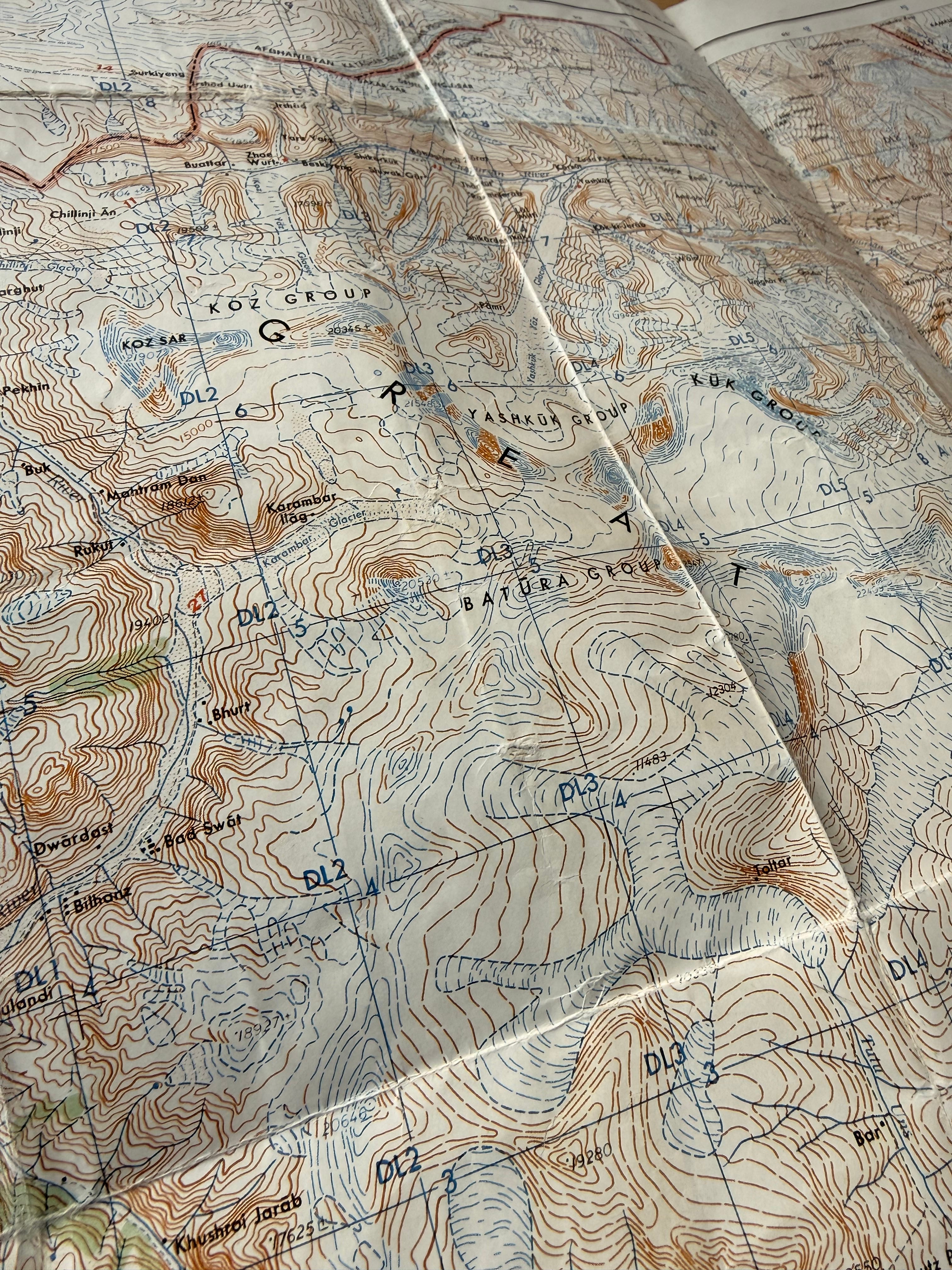
This is a map of an area in North West Pakistan. Part of the Hindu Raj range with the Afghan border just to the North. This is a beautiful and rugged area, and you wouldn’t know unless you went that the map is wrong. We did, and we learned.
Since those early demonstrations, the tech sector has poured over analytics and heatmaps trying to understand how different people interact with different web experiences. This was done to build usability into web products to achieve specific business goals: buying products, clicking likes, and understanding information.
In the geospatial world, we also care about how people think about and use maps (at Sparkgeo, we even built a web maps analytics technology, with mixed success). But I would argue that again, Google “took the map UI biscuit” with the development of Google Maps and Earth. Repeating their previous success with the same strategy: applying simplicity to potentially complex interfaces.
For the past 20 years, the web community has been obsessed with user experience. We did this because we were building experiences for the masses. The power of web products lies in meeting the needs of as many users as possible. That’s the key concept of scalability. That’s both the allure and the foundational business model. So what happens when people can easily build their own software? What then happens to the interface to that software?
I asked a Limited Partner of a large VC firm in Seattle where he felt the moat for SAAS softarware was, and his answer was illuminating.
Personal software is one question, but agentic computing is another. I built an agent that can pass the GISP. Then I built an agent that can interpret a GIS request and parse it out to a “team” of agents designed to replicate a typical GIS office. You know, the GIS technician, the GIS Analyst, the GIS Developer. These are all archetypes I’ve encountered throughout my career. Across European, North American, and Middle Eastern cultures, I met the same archetypes in GIS offices. I have been one, am one.
There was once a deep technical barrier to using geographic data. One had to be able to diagnose problems with data (because it’s always just various forms of bad). One had to set reasonable expectations for analytic capabilities and approaches to data science questions. One had an encyclopedic knowledge of where useful datasets reside and how to access them. One had to know how to move data from one form to another and safely transform coordinates and areas across projection systems without too much accuracy loss. And then one had to be able to actually design and run a geographic process, a workflow.
Reread that paragraph, and I will let you decide if the technical moat of the digital geographer has been eroded. I find this fearsome, but also somewhat exhilarating. In the end, we should remember that GIS has always been a tool for data exploration. A tool to ensure data makes sense, to get a visual. Actual analysis or workflows would be delivered elsewhere.
I think we are at a moment of change. We have more data than we have ever had. Far too much data for any single organization to adequately parse. We’ve needed machines to help us for years; they’ve just now caught up with our needs. The Earth Observation community can begin meeting some of the expectations the general public has had of us for years.
Here are some core strategic themes to keep in mind as we navigate the next few years.
Time is a first-class citizen in geospatial.
With the torrent of data flowing out of Low Earth Orbit, from swarms of drones, and from the billions of smart devices carried by every networked human, snapshots of analysis are now somewhat meaningless. Time is a first-class citizen in geography. This means maps need to be living representations of our changing planet. Whether that’s changing storefronts, new urban development, or more catastrophic change from conflict, social unrest, or climate change, maps are not static. More importantly, users of mapping and geographic products expect technology to reflect their experiences.
Approaches: Build tools, agents, and experiences for change.
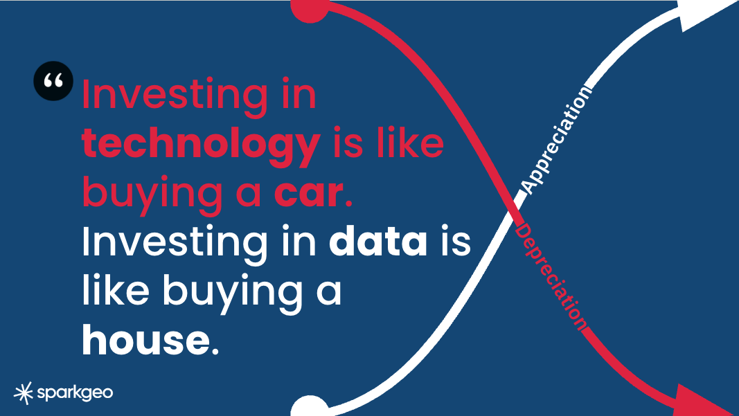
Investing in technology is like buying a car; investing in data is like buying a house.
Continuing the idea of time, we can see how a corpus of data can accrue value over time. The notion of change is really a factor of time; we can only detect anomalies or changes if we have a baseline created over an extended period. So, more data leads to a better baseline and a better understanding of landscape changes or human activity. Investing in data and access to that data is an investment that will grow in value.
Conversely, as soon as an interface is built, it’s out of date. In the mid-2010s, I would say this based on the frequency of JavaScript framework updates and changes. Now it’s because user interfaces have become virtually ephemeral. I know my team have built interfaces that are useful for only 15 minutes. So, with the idea of personal software comes the reality that interfaces depreciate faster than ever.
I remember when it was futuristic to consider an API as a user; now we need to consider agents as users. Practically speaking, an MCP environment is really not much different from an API. But they are different and should be treated as such. For instance, neither should be subject to a 2000-feature limit.
Approaches: robust and secure programmatic data access is a great investment. Care more about data, because your users will be building their own unique interfaces.
Your personal moat might be in your ability to think spatially.
As referenced originally in the GEOFESTO a couple of years ago. Even if LLMs take all our jobs, people still need to think spatially to ask robust questions about geography. So I believe there is value in thinking through the implications of spatial and geographic context. The natural extension of this thought is that, while I worry about the GIS office in general, I believe there will be a job for the GIS Analyst, or ‘spatial data scientist.’ The ability to think spatially is not an attribute everyone is blessed with, and as the technical barriers to digital geography drop, those questions could be incorporated more easily into everyday business decision-making.
Approaches: ‘Spatial’ is a way of thinking, cultivate it, share it.
Geography can (and maybe should) be componentized.
Things are going to have to shake out. There will be disastrous mistakes made by AIs, as there have been terrible stories of people blindly following GPS directions into disaster. But we can reduce these problems by componentizing data products and processes. It’s clear that AI will use convenient components when asked; those tools can ensure robust geographic processes are followed. In many ways, the open community have been using the GEOS and GDAL libraries for this very reason. The same can be true of mapping interfaces, geospatial data access, and a common understanding of time, geography and spectra. In many ways, CEOS’s ARD efforts provide directionality towards a more componentized future.
Approaches: In your organization, build and make available components to ensure that any internal AIs use your authoritative geospatial data and display it correctly. This practice should desilo geospatial activities to minimize the risk of AI misuse. An unintended consequence may be increased use of geographic data and tools, driven by the availability of componentry for broader AI use.